[Leicester North]
[Abbey Lane Area]
[North Viaduct]
[Leicester Central]
[Braunstone Gate]
[Goods Yard]
[Aylestone]
[Bridging the Gap]
[Notes for Visitors]
[Old Photographs]
[Archive]
[Links]
Old Photographs Section
This section shows old Great Central scenes around Leicester, and is arranged north to south
This is an interactive panorama photograph of the north viaduct, taken on 18th November 1973. Click on it to start the panorama (note that it may take a little time to fully download).
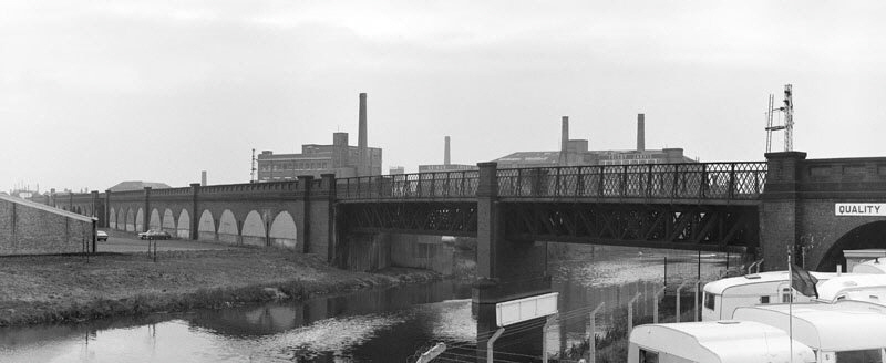
Photograph taken with a panorama camera (so the perspective looks a bit strange) of the north viaduct by St. Magaret’s Way in January 1975. Ravensbridge Drive disappears through the last bridge on the right, just beyond the white painted arch. The only part of the viaduct and bridges that here remain today are the viaduct on the far left and the single arch painted white on the right. Click here or on the photograph above to go to a larger image.
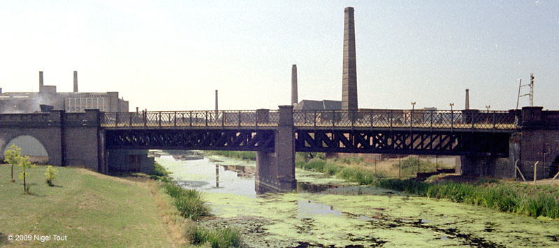
The north viaduct and the bridge over the river Soar, looking west, August 1975.

Panoramic photograph of the north viaduct from Slater Street, looking west, in January 1975.

Panoramic photograph taken outside the north end of Leicester Central station in 1981, looking north. Soar Lane heads under the bridge on the left, Van Damme Bar (the ex-Great Central Hotel) is in the centre, and Northgate Street bridge is straight on. A crane has arrived on the trackbed on the left in preparation for the demolition of the bridges.
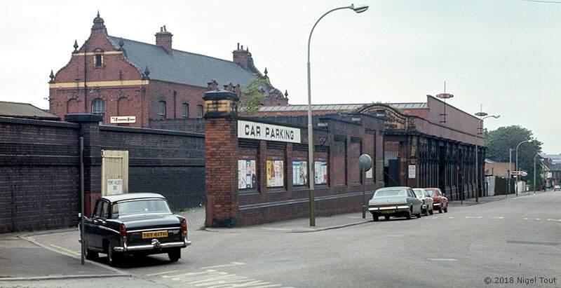
The frontage of Leicester Central station. The roadway on the left was the entrance to the parcels dock, the roof of which can just be seen above the wall at far left. After the station closed the area around the parcels dock was converted to a public car park with this roadway initially as the entrance. May 1976.
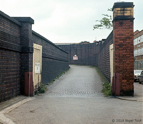
The roadway to the parcels dock, by this time a car parking area, with its interesting blind corner. May 1976.
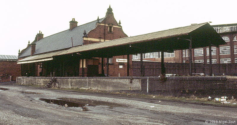
The parcels dock in front of the parcels office, with the surrounding area being used as a car park, in April 1979.
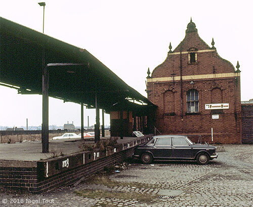
The parcels dock, with the surrounding area being used as a car park, in April 1979.
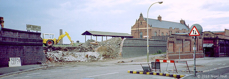
In order to develop the small industrial estate where the station platforms used to be, a hole was made in the wall to the parcels dock area and a sloping access road was laid. This also allowed easier access to an enlarged car park which was created in the area to the left. July 1970.

The Great Central viaduct alongside Dunns Lane, looking north, in 1976. Prominent in the centre is the “West End Inn” with its advertisement for Double Diamond beer. The name was later changed to the “Pump & Tap” and it was demolished in late 2009.

Panoramic photograph of the bowstring bridge on Braunstone Gate, in 1976.
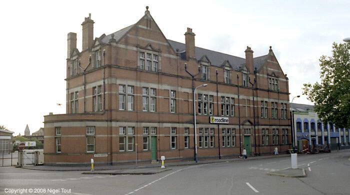
The Great Central Railway goods offices at the Western Boulevard goods depot. After closure for railway use the goods depot was taken over by British Road Services (which became roadline) as a distribution depot. The offices were later demolished when this whole area was redeveloped as a business park.
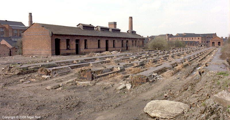
The remains of the carriage sidings and the gas works building, originally used for generating gas for lighting the coaches, looking north, 1979. The main line and goods warehouse are off the picture on the right, while the Old River Soar runs behind the building.
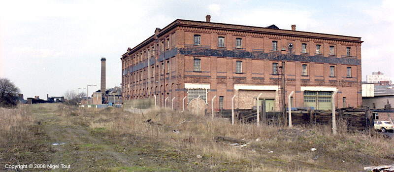
The goods shed, 1979, seen while standing on the track bed of the main line, looking north, with the Braunstone Gate ‘Bowstring’ bridge just visible in the distance.
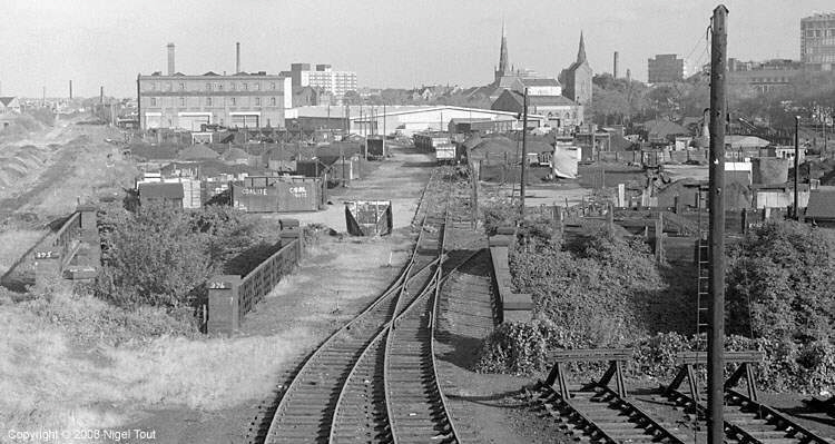
The south goods yard from Upperton Road bridge, showing the coal sidings which were soon to become the major part of Vic Berry’s scrap yard, 1973. The goods warehouse is to the left of centre, with the track bed of the main line passing it on the left. By this date access to these sidings was via the new chord line from the ex-Midland Railway Leicester-Burton line, see below.
More photographs of activity here are in the Old Photographs; Trains section and more extensive coverage can be found on the associated website at http://www.nigeltout.com/html/three-leicester-railway-scrapyards.html.

A panoramic photograph taken in summer 1976 from Upperton Road bridge gives a good overview of the layout of the approaches to the goods yards over bridges across the Old River Soar. On the right the scrap yards of A.E. Piggot & Sons and Frank Berry occupy that corner of the goods yard.
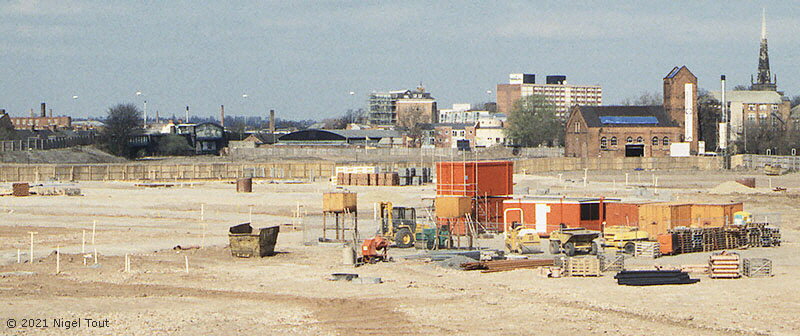
This is an interesting view from Upperton Road in 1997 that was briefly made possible by the clearing of the scrapyards, the demolition of the Great Central goods shed and surrounding buildings, and before the site was redeveloped. On the far left the Great Central Way heads across the ‘Bowstring Bridge’ in the distance while on the right is the ex-GCR power house which was subsequently converted into a pub, before becoming a Tesco supermarket.
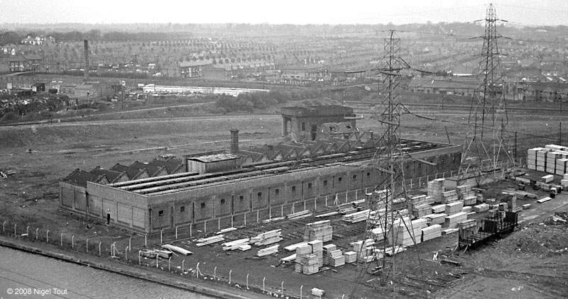
Leicester Great Central Railway engine shed photographed from the roof of Leicester power station (itself now long demolished) in April 1967.
The shed had been closed
for a few years and through trains to London had ceased the year before. Local freight traffic was still being handled, as evidenced by the two wagons in the timber yard alongside the shed.
The GC main line runs from right
to left in the background, while the Midland Railway’s Leicester to Burton line runs diagonally from left top to centre top. The embankment of the new connecting chord line can be seen curving down from the Midland to
the GC.
At bottom left is the Grand Union canal. A gap in the fence from the tow path allowed the spotter access to the engine shed, while no one was looking!

The area to the side of the loco shed from across the canal, with the remains of the coaling stage with water tank on top in the centre. Compare these with photographs when the shed was still in use and inside the shed when it was derelict.
The ex-Midland
Railway’s Leicester to Burton line is on the far left, from which the new chord runs down to the GC in the distance.
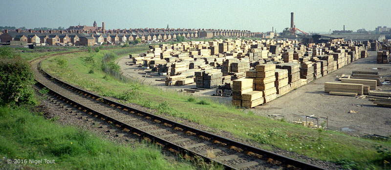
The new chord from the ex-Midland Railway’s Leicester to Burton line down to the GC track bed in the distance. The stacks of wood are on the site of the Great
Central locomotive shed.
Photograph taken from the passing ‘Ruddington Requiem’ special train, 9/6/84.
Old Photographs Section
[Leicester North]
[Abbey Lane Area]
[North Viaduct]
[Leicester Central]
[Braunstone Gate]
[Goods Yard]
[Aylestone]
[Bridging the Gap]
[Notes for Visitors]
[Old Photographs]
[Archive]
[Links]
© 2001-2025 Text and photographs copyright Nigel Tout, unless otherwise indicated.
